The idea
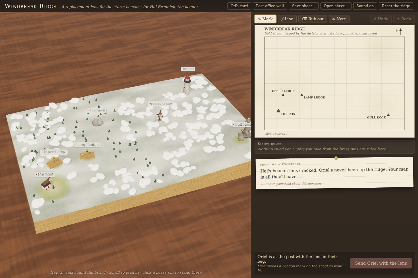
Oriel has a delivery to make and your map is all they have. Take bearings from survey pins, decide what you saw, mark the destination and draw a route. The return report becomes evidence for revising the sheet, rather than an automatic correction to the world’s true coordinates.
An information boundary you can play
The traveler receives the player’s map and short-range movement feedback. Hidden terrain stays behind a separate adapter. Reports are composed from what happened locally: a blocked route, a visible carving, a bridge that will not carry a loaded cart.
Three main expeditions change the source of difficulty. Windbreak Ridge introduces geometry; Switchback Pass adds a transport constraint; Twin Orchard makes identity as important as a precise bearing. A well-measured location can still be the wrong destination. Portable saves preserve the sheet and completed trips so the explanation can be revisited.
The collaboration
Codex built the geometry and traveler core. Claude Code authored the landscape, diorama, sheet and experience, with joint interface review. The project’s central rule—no hidden route oracle for the courier—connects the player’s mistakes to visible, understandable consequences.
Limitations
- The simulation uses declared geometry and movement assumptions.
- Engineering replays and agent probes do not establish physical-device performance or human enjoyment.
- The field-sheet interface is best explored on desktop; the current mobile layout can clip dense controls.
Source code & evidence
Results reflect the linked evidence snapshots. Source artifacts retain their dates and experimental conditions.